(Uitgeest/ Alkmaar 1571 – 1638 Amsterdam)
In eigentijdse bruine kalfsbinding met 42 grafieken. 255 x 290 mm.
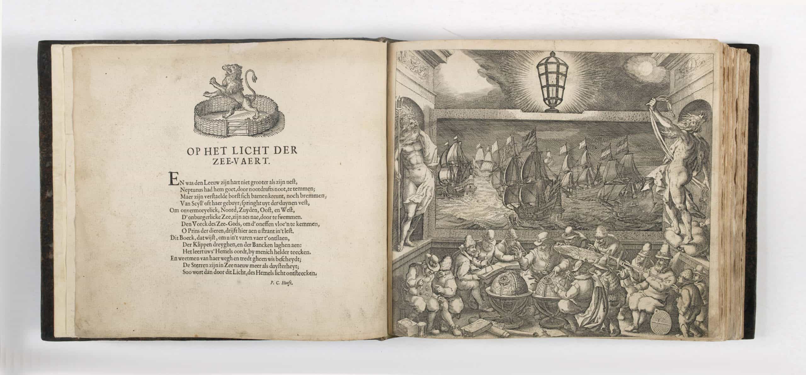
Het Licht der Zee-vaert daerinne claerlijck beschreven ende afghebeeldet werde, alle de Custen ende Havenen, vande Westersche, Noordsche, Oostersche ende Middelandsche Zee’n, 1630.
Deze editie uit 1630 is de laatst bekende voorgaande Nederlandse editie van het Licht der Zee-vaert, gedrukt door Blaeu en is slechts in 2 exemplaren bekend.
Referenties: Koeman: Atlantes Neerlandici, deel 4, M.BL7. Deze editie is zeer zeldzaam; Prof. Koeman noemt slechts twee exemplaren. Dit exemplaar en één in de Koninklijke Bibliotheek van Stockholm.
Het Licht der Zee-vaert (1608) and the Zeespiegel (1623) were revolutionary, being the first broadly accurate maritime atlases and remained the ultimate guide to navigation in Europe for many years.
Blaeu later went on to create globes, magnificent wall maps, large-format charts and eventually terrestrial atlases, all decorated with the finest Dutch Baroque artistry. Towards the end of his life, Willem Blaeu published the Atlas Novus (1635), a grand production that would be progressively expanded to include new volumes featuring the entire known world in unprecedented detail.
This worked proved in demand as it updated the pioneering chart atlases of Lucas Waghenaer dating from the 1580s. None of the charts is signed by the engraver, but Destombes has conjectured that he might have been Joshua van den Ende.
The last known foregoing Dutch edition of the Licht der Zee-vaert, printed by Blaeu, is dated 1620. In the same year 1620 Johannes Janssonius reprinted for the first time Blaeu’s pilot-guide, in Dutch, French and English. After 1620, both Blaeu and Janssonius published various editions. Blaeu printed a new version with Dutch text (1629/1630) and altered his work in several places to compete with Janssonius. The text was reset and considerably modified. There is only one single page chart (35), and charts numbered 39 and 40 have replaced the charts 37 and 38.
The Licht der Zee-Vaert consist of three parts, the introduction, which is an instruction in the art of navigation; the first book dealing with the Western navigation and the second book dealing with the Eastern and Northern navigation. Apart from the charts, which are printed from copperplates, many coastal profiles in the text are printed from wood blocks.
Bezoek aan onze galerie
Je bent van harte welkom om te genieten van onze collectie schilderijen.
Bezoek alleen op afspraak
Ma t/m vr telefonisch 10:00 – 18:00
Oosterzijweg 124
1851 PS Heiloo, Netherlands
Bezoek alleen op afspraak
Maandag tot en met vrijdag
Van 10:00 tot 18:00
© 2022 Rob Kattenburg
Website Mediya.nl